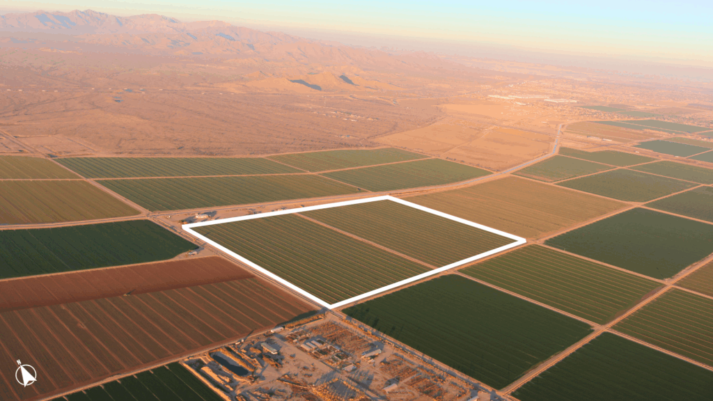
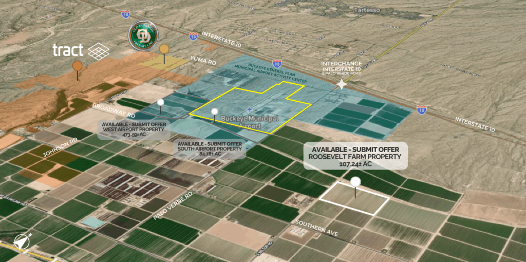
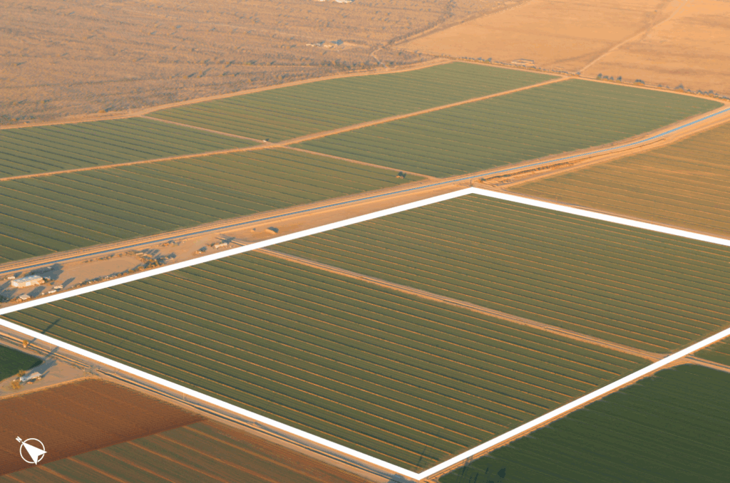
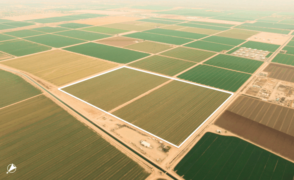
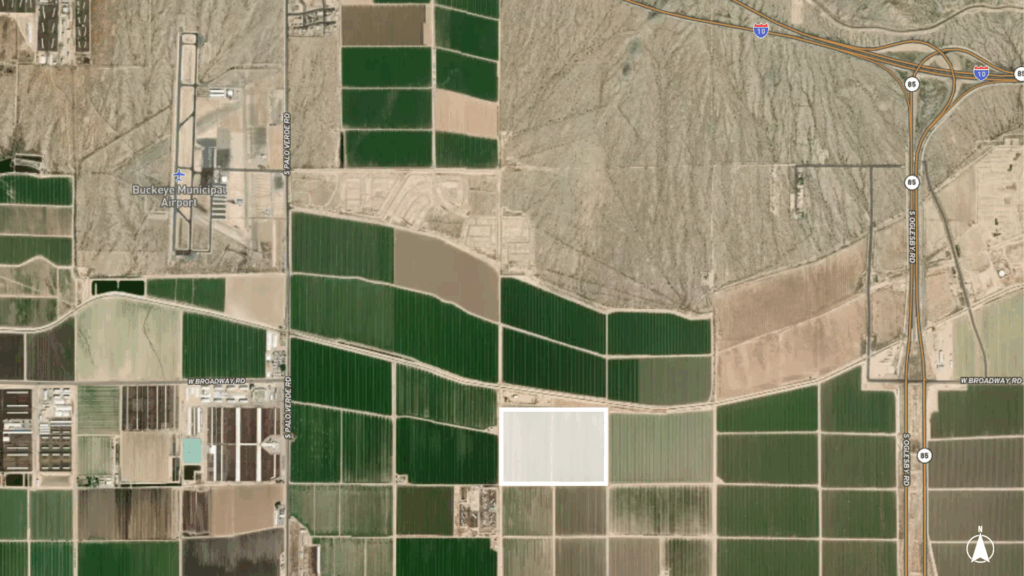
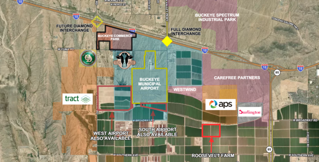
The 107.24+/- Acre Roosevelt Farm Property is located southeast of the Buckeye Municipal Airport (Click here for link to Airport Plan.) The current zoning is City of Buckeye Planned Community (PC). This property lies within the Master Planned Community designation of the City of Buckeye’s General Plan.
The property lies in the heart of the West Buckeye planning area. Lying 1/4 mile north of paved Southern, with easy access to Interstate 10 via Palo Verde Road Interchange or Arizona Highway 85. Property is located in the Arizona Opportunity Zone and Foreign Trade Zone 277. This property has grandfathered groundwater irrigation rights & receives water from the Roosevelt Irrigation District.
ZONING: City of Buckeye PC (Planned Community) , City of Buckeye General Plan: Master Planned Community
MARICOPA COUNTY APNs: 504-38-005D , 504-38-002A
WATER: Located within the Phoenix AMA, property includes ADWR Grandfathered Groundwater Irrigation Rights (58-102356.0004) from the Roosevelt Irrigation District